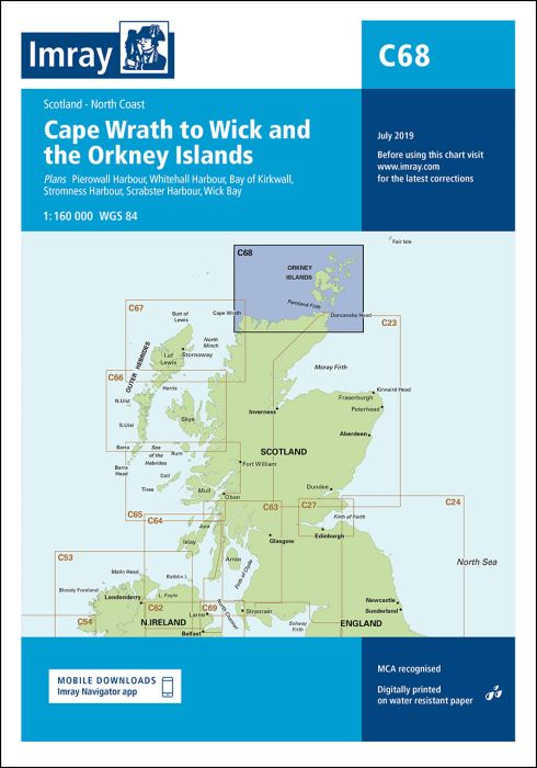
Plans included:
Pierowall Harbour (1:40 000)
Whitehall Harbour (1:25 000)
Bay of Kirkwall (1:12 500)
Stromness Harbour (1:12 500)
Scrabster Harbour (1:7500)
Wick Bay (1:10 000)
On this edition the latest depths have been applied where available. The chart specification has been improved to show coloured light flashes. There has been general updating throughout.
| Artikelnummer | BD2879 |
|---|---|
| Haupttitel | C68 Cape Wrath to Wick and the Orkney Islands |
| ISBN | 9781846239298 |
| EAN | 9781846239298 |
| Hersteller / Verlag | Imray |
| Rückgaberecht | Gemäss unseren AGBs |
| Produkttyp | Karte |
| Medium / Produktart | Papier |
| Kategorien | Seekarte/Binnenkarte |
| Sprache | Englisch |
| Land / Region | Schottland |
| Gewässer | Atlantischer Ozean, Nordsee |
| Erscheinungsjahr | 2021 |
| Ausführung | Gefaltet, in Plastikmappe |
| Massstab | 1:160'000 |
| Kartentyp | 1:30'000 bis 1:300'000 |
| Kartenlänge offen (cm) | 78,7 |
| Kartenbreite offen (cm) | 111,8 |
| Gewicht (kg) | 0.13 |
| Dimension 1 (cm) | 33 |
| Dimension 2 (cm) | 24 |










Validate your login
Anmelden
Neuen Account erstellen