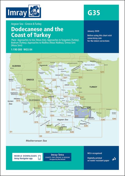
Plans included:
Approaches to Kós (Nísos Kós) (1:20 000)
Approaches to Turgutreis (Turkey) (1:100 000)
Bodrum (Turkey) (1:20 000)
Approaches to Ródhos (Nísos Ródhos) (1:30 000)
Órmos Sími (Nísos Sími) (1:40 000)
On this edition the latest depth surveys have been applied where available. Seaplane operating and landing areas are now shown. Completed works at Rhodes marina is also shown. General updating throughout.
| Artikelnummer | BD2942 |
|---|---|
| Haupttitel | G35 Dodecanese and the Coast of Turkey |
| ISBN | 9781846237621 |
| EAN | 9781846237621 |
| Hersteller / Verlag | Imray |
| Rückgaberecht | Gemäss unseren AGBs |
| Produkttyp | Karte |
| Medium / Produktart | Papier |
| Kategorien | Seekarte/Binnenkarte |
| Sprache | Englisch |
| Land / Region | Ägäis, Dodekanes, Griechenland, Sporaden (Südliche), Türkei |
| Gewässer | Aegäisches Meer, Mittelmeer |
| Erscheinungsjahr | 2016 |
| Aktualisiert | 2020 |
| Ausführung | Gefaltet, in Plastikmappe |
| Massstab | 1:190'000 |
| Kartentyp | 1:30'000 bis 1:300'000 |
| Kartenlänge offen (cm) | 64 |
| Kartenbreite offen (cm) | 90 |
| Gewicht (kg) | 0.13 |
| Dimension 1 (cm) | 33 |
| Dimension 2 (cm) | 24 |


Validate your login
Anmelden
Neuen Account erstellen