Plans included:
Newquay Bay (1:10 000)
Saint Ives (1:15 000)
St Mary’s Road (1:25 000)
Hugh Town (1:10 000)
Mousehole (1:5000)
Newlyn Harbour (1:12 000)
Penzance (1:12 000)
Saint Michael’s Mount (1:12 500)
Porthleven (1:5000)
Mullion Cove (1:7500)
On this edition the latest available depth surveys have been applied. The chart specification has been improved to show coloured light flashes. There has been general updating throughout.
Printed and corrected to January 2022
| Artikelnummer | BD2832 |
|---|---|
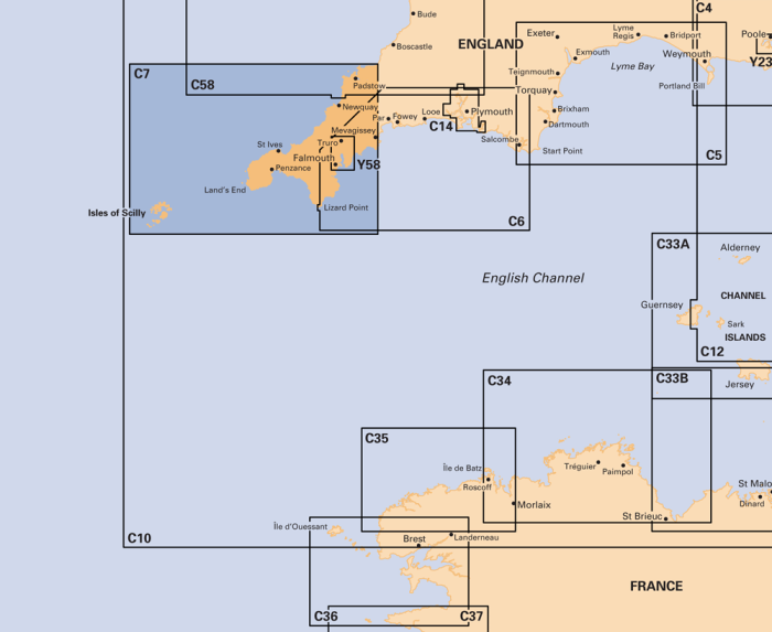
| Haupttitel | C7 Falmouth to Isles of Scilly and Trevose Head |
| ISBN | 9781846239304 |
| EAN | 9781846239304 |
| Hersteller / Verlag | Imray |
| Rückgaberecht | Gemäss unseren AGBs |
| Produkttyp | Karte |
| Medium / Produktart | Papier |
| Kategorien | Seekarte/Binnenkarte |
| Sprache | Englisch |
| Land / Region | England |
| Gewässer | Atlantischer Ozean, Keltische See |
| Erscheinungsjahr | 2022 |
| Ausführung | Gefaltet, in Plastikmappe |
| Massstab | 1:120'000 |
| Kartentyp | 1:30'000 bis 1:300'000 |
| Kartenlänge offen (cm) | 78,7 |
| Kartenbreite offen (cm) | 111,8 |
| Gewicht (kg) | 0.13 |
| Dimension 1 (cm) | 33 |
| Dimension 2 (cm) | 24 |



Validate your login
Anmelden
Neuen Account erstellen