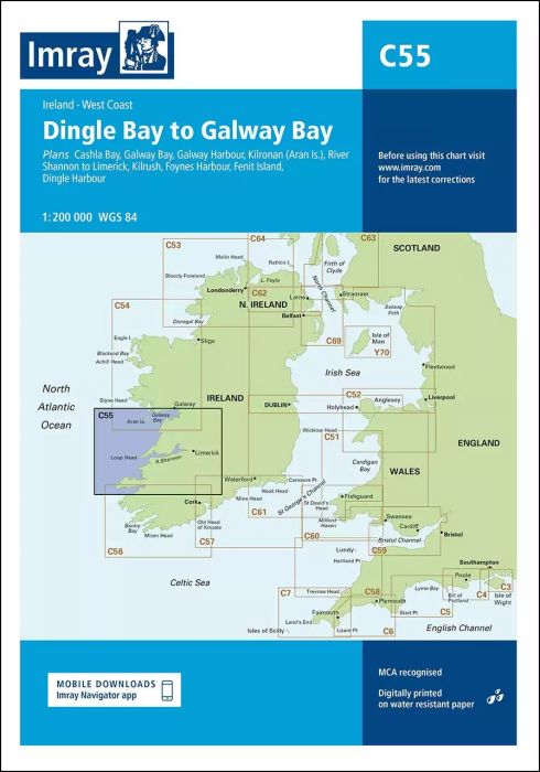
Plans included:
Cashla Bay (1:30 000)
Galway Bay (1:40 000)
Galway Harbour (1:15 000)
Kilronan (Aran Is.) (1:45 000)
River Shannon to Limerick (1:110 000)
Kilrush (1:30 000)
Foynes Harbour (1:17 500)
Fenit Island (1:35 000)
Dingle Harbour (1:25 000)
On this edition revised depths are shown throughout, in particular at Cashla Bay, Galway Bay, Kilronan, around Fenit Island and at Dingle Bay. Completed harbour developments at Kilronan are also shown.
| Artikelnummer | BD2866 |
|---|---|
| Haupttitel | C55 Dingle Bay to Galway Bay |
| ISBN | 9781846236853 |
| EAN | 9781846236853 |
| Hersteller / Verlag | Imray |
| Rückgaberecht | Gemäss unseren AGBs |
| Produkttyp | Karte |
| Medium / Produktart | Papier |
| Kategorien | Seekarte/Binnenkarte |
| Sprache | Englisch |
| Land / Region | Irland |
| Gewässer | Atlantischer Ozean |
| Erscheinungsjahr | 2015 |
| Aktualisiert | 2023 |
| Ausführung | Gefaltet, in Plastikmappe |
| Massstab | 1:200'000 |
| Kartentyp | 1:30'000 bis 1:300'000 |
| Kartenlänge offen (cm) | 78,7 |
| Kartenbreite offen (cm) | 111,8 |
| Gewicht (kg) | 0.13 |
| Dimension 1 (cm) | 33 |
| Dimension 2 (cm) | 24 |








Validate your login
Anmelden
Neuen Account erstellen