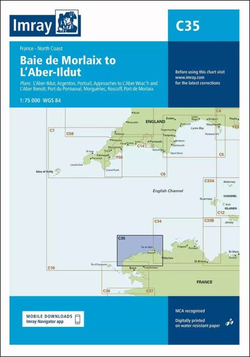
Plans included:
L’Aber-Ildut (1:25 000)
Argenton (1:25 000)
Portsall (1:20 000)
Approaches to L’Aber Wrac’h & L’Aber Benoît (1:30 000)
Port du Pontusval (1:15 000)
Moguériec (1:32 000)
Roscoff (1:20 000)
Port de Morlaix (1:15 000)
On this edition the chart specification has been improved to show coloured light flashes. Updated depth surveys have been included where applicable. The harbour plans of L’Aber-Ildut and Argenton are now drawn at a scale of 1:25 000. The plan showing the approaches to Roscoff has been extended east to include better approach coverage to Bloscon Marina. There has been general updating throughout.
| Artikelnummer | BD2855 |
|---|---|
| Haupttitel | C35 Baie de Morlaix to L'Aber-Ildut |
| ISBN | 9781786790576 |
| EAN | 9781786790576 |
| Hersteller / Verlag | Imray |
| Rückgaberecht | Gemäss unseren AGBs |
| Produkttyp | Karte |
| Medium / Produktart | Papier |
| Kategorien | Seekarte/Binnenkarte |
| Sprache | Englisch |
| Land / Region | Frankreich |
| Gewässer | Aermelkanal |
| Erscheinungsjahr | 2019 |
| Aktualisiert | 2023 |
| Ausführung | Gefaltet, in Plastikmappe |
| Massstab | 1:75'000 |
| Kartentyp | 1:30'000 bis 1:300'000 |
| Kartenlänge offen (cm) | 78,7 |
| Kartenbreite offen (cm) | 111,8 |
| Gewicht (kg) | 0.13 |
| Dimension 1 (cm) | 33 |
| Dimension 2 (cm) | 24 |








Validate your login
Anmelden
Neuen Account erstellen