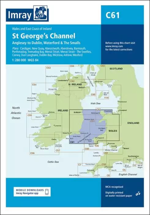
Wales to the East Coast of Ireland
Plans included:
Cardigan (1:40 000)
New Quay (1:20 000)
Aberystwyth (1:20 000)
Aberdovey (1:50 000)
Barmouth (1:30 000)
Porthmadog (1:75 000)
Tremadog Bay (1:75 000)
Menai Strait (1:80 000)
Menai Strait - The Swellies (1:25 000)
Conwy (1:30 000)
Dun Laoghaire (1:25 000)
Dublin Bay (1:90 000)
Wicklow (1:10 000)
Arklow (1:15 000)
Wexford (1:75 000)
On this edition the chart specification has been improved to show coloured light flashes. The firing practice areas have been updated and the extents of the Skomer I. Marine Reserve is shown. There has been general updating throughout.
| REF | BD2872 |
|---|---|
| Nom de produit | C61 St George's Channel |
| Short Description | Anglesey to Dublin, Waterford and the Smalls |
| ISBN | 9781786792143 |
| EAN | 9781786792143 |
| Fabricant / éditeur | Imray |
| Droit de retour | Selon nos termes et conditions |
| Type de produit | Carte |
| Type de produit | Papier |
| Catégories | Carte nautique |
| Langue | Anglais |
| Pays / Région | Angleterre, Irlande |
| Eaux | Mer d'Irlande, Mer Celtique, Canal Saint-Georges |
| Année de publication | 2020 |
| Mis à jour | 2023 |
| Type de reliure | Pliées en portefeuille plastique |
| Échelle de la carte | 1:280'000 |
| Type de cartes nautiques | 1:30'000 bis 1:300'000 |
| Longueur de la carte ouverte (cm) | 78,7 |
| Largeur de la carte ouverte (cm) | 111,8 |
| Poids (kg) | 0.13 |
| Dimension 1 (cm) | 33 |
| Dimension 2 (cm) | 24 |







Validate your login
Se connecter
Créer un nouveau compte