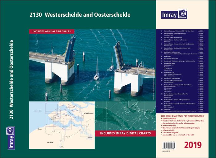
Part of Imray’s popular small format chart coverage for the Netherlands, this atlas is a convenient A2 format, wirobound along one edge.
Includes download Part of Imray’s popular small format chart coverage for the Netherlands, this atlas is a convenient A2 format, wirobound along one edge.
Includes extensive coverage of Westerschelde, Kanaal Gent-Terneuzen, Oosterschelde, Veerse Meer, Zoommeer, plus canal links and North Sea coastal approaches.
This 2019 edition has been fully updated throughout using the latest depth surveys. Harbour developments are included.
- Westerschelde and Oosterschelde Overview Chart (1:225 000)
- Westerschelde - Oostgat Approaches (1:45 000) includes plan Cadzand-Bad (1:10 000)
- Entrance to the Westerschelde (1:35 000)
- Westerschelde - Breskens to Terneuzen (1:35 000) Includes plan of Breskens (1:15 000)
- Westerschelde - Terneuzen to Hoek van Ossenisse (1:35 000) Includes plan of Terneuzen (1:20 000)
- Westerschelde - Hoek van Ossenisse to Bath (1:35 000) Includes plan of Walsoorden (1:10 000)
- Approaches to Antwerpen (1:30 000) Includes Continuation of Schelde-Rijnverbinding to Zoommeer (1:30 000)
- Antwerpen (1:30 000)
- Kanaal Gent-Terneuzen (1:30 000)
- Kanaal door Walcheren - Vlissingen to Kleverskerke (1:20 000)
- Veerse Meer West (1:20 000) Includes plans of Oostwatering (1:15 000), Veere (1:10 000), Oranjeplaat (1:15 000) and De Omloop (1:10 000)
- Veerse Meer East (1:20 000) Includes plans of Kortgene & Wolphaartsdijk (1:10 000) andZandkreeksluis (1:10 000)
- Kanaal door Zuid-Beveland (1:17 500)
- Entrance to the Oosterschelde (1:45 000) Includes plan of Roompotsluis (1:30 000)
- Oosterschelde - Roompotsluis to Zeelandbrug (1:35 000) Includes plans of Roompot Marina (1:20 000), Colijnsplaat (1:15 000), Zierikzee (1:15 000) and Burghsluis (1:15 000)
- Oosterschelde - Zeelandbrug to Yerseke (1:35 000) Includes plans of Goessche Sas (1:10 000) and Stavenisse (1:15 000)
- Oosterschelde - Yerseke to Bergsediepsluis (1:35 000) Includes plan of Yerseke (1:12 500)
- Oosterschelde - Keeten to Krammer & Krabbenkreek (1:35 000) Includes plans of Bruinisse (1:15 000) and Sint Annaland (1:15 000)
- Zoommeer (1:15 000) Includes Continuation of Schelde-Rijnverbinding to Volkerak (1:45 000)
Imray Digital Charts: Free mobile download
A voucher code to download ID80 Imray Netherlands charts into Imray Navigator (our app for iPad, iPhone and Android) is included with this atlas.ode for more than 140 digital charts covering all of the Netherlands on the Imray Navigator charts app.
| REF | BD6698 |
|---|---|
| Nom de produit | 2130 Westerschelde and Oosterschelde |
| Short Description | Chart Atlas 2019 |
| ISBN | 9781786790835 |
| EAN | 9781786790835 |
| Fabricant / éditeur | Imray |
| Droit de retour | Selon nos termes et conditions |
| Type de produit | Carte |
| Type de produit | Papier |
| Catégories | Carte nautique |
| Langue | Anglais |
| Pays / Région | Pays-Bas |
| Eaux | Mer du Nord |
| Année de publication | 2019 |
| Type de reliure | Reliure à spirale |
| Échelle de la carte | Div. Massstäbe |
| Type de cartes nautiques | Jeu de cartes - différentes échelles |
| Poids (kg) | 0.13 |
| Dimension 1 (cm) | 59 |
| Dimension 2 (cm) | 42 |








Validate your login
Se connecter
Créer un nouveau compte