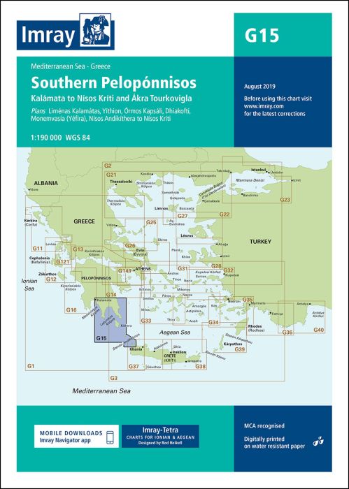
Plans included:
Liménas Kalamátas (1:12 500)
Yíthion (1:12 500)
Órmos Kapsáli (1:5000)
Dhiakofti (1:12 500)
Monemvasía (Yéfira) (1:7500)
Nísos Andikíthera to Nísos Kríti (1:190 000)
On this edition the chart specification has been improved to show coloured light flashes. The chart has been reschemed and is now portrait so to include the passage to Crete. The overlap with adjoining chart G16 has been reduced so G15 now shows the area Kalámata to Nísos Kríti and Ákra Tourkovigla. The latest harbour works at Yíthion are included as are the completed harbour works at Monemvasía (Yéfira). The harbour plan of Koróni is not included in this edition. There has been general updating throughout.
| SKU | BD2927 |
|---|---|
| Product Name | G15 Southern Peloponnisos |
| Short Description | Órmos Navarínou to Nísos Kithíra and Ákra Tourkovigla |
| ISBN | 9781786790415 |
| EAN | 9781786790415 |
| Manufacturer / Publisher | Imray |
| Refund policy | According to our AGB |
| Product type | Map |
| Medium / product type | Paper |
| Categories | Nautical chart |
| Language | English |
| Country / Region | Greece |
| Waters | Ionian Sea |
| Publishing year | 2018 |
| Updated | 2019 |
| Binding type | Folded in plastic wallet |
| Map scale | 1:190'000 |
| Charts type | 1:30'000 bis 1:300'000 |
| Card length open (cm) | 64,0 |
| card width open (cm) | 90,0 |
| Weight (kg) | 0.13 |
| Dimension 1 (cm) | 33 |
| Dimension 2 (cm) | 24 |




Validate your login
Sign In
Create New Account