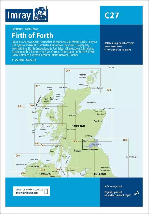
Plans included:
St Andrews (1:7500)
Crail (1:7500)
Anstruther (1:7500)
St Monans (1:7500)
Elie (1:10 000)
Methil Docks (1:11 000)
Pettycur & Kinghorn (1:17 500)
Inchkeith (1:25 000)
Burntisland (1:20 000)
Aberdour (1:12 500)
Inchcolm (1:15 000)
Dalgety Bay (1:15 000)
Inverkeithing (1:15 000)
North Queensferry & Port Edgar (1:20 000)
Charlestown & Limekilns (1:15 000)
Grangemouth & Entrance to River Carron (1:17 500)
Continuation to Forth & Clyde Canal Entrance (1:17 500)
Granton (1:12 500)
Fisherrow (1:12 500)
North Berwick (1:7500)
Dunbar (1:7500)
On this edition the chart specification has been improved to show coloured light flashes. Depths have been updated from the latest surveys where available. Additional tidal stream data has been added. There has been general updating throughout.
| Cod.Art. | BD2846 |
|---|---|
| Nome prodotto | C27 Firth of Forth |
| ISBN | 9781786790590 |
| EAN | 9781786790590 |
| Produttore / Editore | Imray |
| Diritto alla restituzione | Secondo i nostri termini e condizioni |
| Tipo di prodotto | Carta |
| Tipologia di prodotto | Carta |
| Categorie | Carta nautica |
| Lingua | Inglese |
| Paese / Regione | Scozia |
| Acque | Mare del Nord |
| Anno di pubblicazione | 2018 |
| Aggiornata | 2023 |
| Tipo di rilegatura | Piegato, in una cartella di plastica |
| Scala della carta | 1:75'000 |
| Tipo di carte nautiche | 1:30'000 bis 1:300'000 |
| Lunghezza della carta aperta (cm) | 78,7 |
| Larghezza della carta aperta (cm) | 111,8 |
| Peso (kg) | 0.13 |
| Dimension 1 (cm) | 33 |
| Dimension 2 (cm) | 24 |


Validate your login
Registrati
Creare un nuovo account