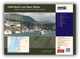
2700.1 Liverpool Bay to Anglesey
1: 280 000
Plans: Holyhead
2700.2 Anglesey and Menai
1: 145 000
Plans: Conwy Bay, Conwy
2700.3 Southern Anglesey and Lleyn Peninsula
1: 145 000
Plans: Porth Dinlläen
2700.4 Cardigan Bay to South East of Ireland
1: 300 000
2700.5 Cardigan Bay
1: 145 000
2700.6 Aberaeron to St David’s
1: 155 000
2700.7 St George’s Channel
1: 280 000
2700.8 Menai Strait and The Swellies
1: 70 000
Plans: Bangor and Beaumaris, The Swellies, Port Dinorwic,
Caernarfon, Llanddwyn Island
2700.9 Cardigan Bay Plans
1: various
Plans: Abersoch, Pwllheli, Porthmadog, Mochras Lagoon, Barmouth, Aberdovey,
Aberystwyth, Aberaeron, New Quay, Aberporth, Cardigan, Newport Bay,
Fishguard
2700.10 Tremadog Bay
1: 80 000
2700.11 Dublin Bay to Anglesey
1: 280 000
Plans: Dublin Bay
2700.12 Liverpool Bay
1: 145 000
Plans: Liverpool
| SKU | BD2758 |
|---|---|
| Product Name | 2700 North and West Wales Chart Pack |
| Short Description | Anglesey to Milford Haven and St George's Channel |
| ISBN | 9781846237980 |
| EAN | 9781846237980 |
| Manufacturer / Publisher | Imray |
| Refund policy | According to our AGB |
| Product type | Map |
| Medium / product type | Paper |
| Categories | Nautical chart |
| Language | English |
| Country / Region | England |
| Waters | Bristol Channel, Irish Sea, Celtic Sea, St George's Channel |
| Publishing year | 2016 |
| Binding type | Coil binding |
| Charts type | Set of cards - different scales |
| Weight (kg) | 0.676 |
| Dimension 1 (cm) | 42,0 |
| Dimension 2 (cm) | 59,0 |


Validate your login
Sign In
Create New Account