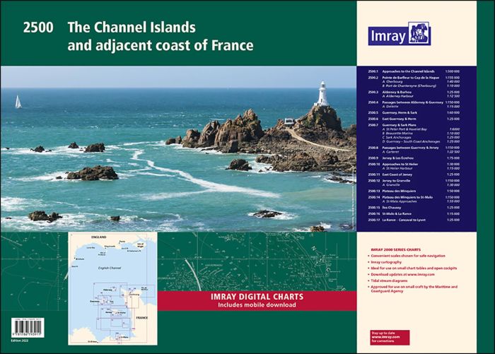
1. Approaches to the Channel Islands
1: 500 000
2. Cap Barfleur to Alderney
1: 150 000
Plans: Cherbourg 1:40 000, Port de Chantereyne (Cherbourg) 1:10 000
3. Alderney & Burhou
1: 25 000
Plans: Alderney Harbour 1:12 500
4. Passages Between Alderney & Guernsey
1: 150 000
Plans: Diélette 1:15 000
5. Guernsey, Herm & Sark
1: 60 000
6. East Guernsey & Herm
1: 25 000
7. Guernsey & Sark Plans
various scales
Plans: St Peter Port & Havelet Bay 1:6 000, Beaucette Marina 1:10 000, Sark Anchorages 1:25 000, Guernsey - South Coast Anchorages 1:25 000
8. Passages Between Guernsey & Jersey
1: 150 000
Plans: Carteret 1:22 500
9. Jersey & Les Écrehou
1: 75 000
10. Approaches to St Helier
1: 30 000
Plans: St Helier Harbour 1:15 000
11. East Coast of Jersey
1: 25 000
12. Jersey to Granville
1: 150 000
Plans: Granville 1:30 000
13. Plateau des Minquiers
1: 50 000
14. Plateau des Minquiers to St-Malo
1: 150 000
Plans: St-Malo Approaches 1:55 000
15. Îles Chausey
1: 25 000
16. St-Malo & La Rance
1: 15 000
17. La Rance - Cancaval to Lyvet
1: 25 000
| SKU | 10580 |
|---|---|
| Product Name | 2500 The Channel Islands and adjacent coast of France Chart Pack |
| ISBN | 9781786793911 |
| EAN | 9781786793911 |
| Manufacturer / Publisher | Imray |
| Refund policy | According to our AGB |
| Product type | Map |
| Medium / product type | Paper |
| Categories | Nautical chart |
| Language | English |
| Country / Region | England |
| Waters | English Channel, Celtic Sea |
| Publishing year | 2022 |
| Binding type | Coil binding |
| Charts type | Set of cards - different scales |
| Weight (kg) | 0.676 |
| Dimension 1 (cm) | 42,0 |
| Dimension 2 (cm) | 59,0 |


Validate your login
Sign In
Create New Account