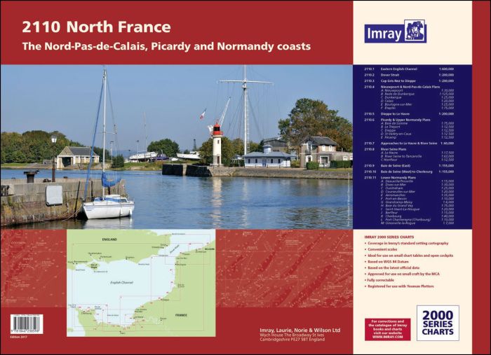
In new A2 atlas format suitable for use on small chart tables and in the cockpit. For this January 2017 edition the latest depth surveys have been applied. The chart specification has been improved to show coloured light flashes and tidal stream information is included. There has been general updating throughout.
The atlas includes-
2110.1 Eastern English Channel
1: 600 000 WGS 84
2110.2 Dover Strait
1: 200 000 WGS 84
2110.3 Cap Gris-Nez to Dieppe
1: 200 000 WGS 84
2110.4 Nieuwpoort & Nord-Pas-de-Calais Plans
Scales: various WGS 84
Plans included:
Nieuwpoort (1:30 000)
Rade de Dunkerque (1:125 000)
Dunkerque (1:25 000)
Calais (1:20 000)
Boulogne-sur-Mer (1:25 000)
Étaples (1:75 000)
2110.5 Dieppe to Le Havre
1: 200 000 WGS 84
2110.6 Picardy & Upper Normandy Plans
Scales: various WGS 84
Plans included:
Baie de Somme (1:75 000)
Le Tréport (1:12 500)
Dieppe (1:12 500)
St-Valéry-en-Caux (1:12 500)
Fécamp (1:12 500)
2110.7 Approaches to Le Havre & River Seine
1: 60 000 WGS 84
2110.8 River Seine Plans
Scales: various WGS 84
Plans included:
Le Havre (1:12 500)
River Seine to Tancarville (1:63 000)
Honfleur (1:12 500)
2110.9 Baie de Seine (East)
1: 155 000 WGS 84
2110.10 Baie de Seine (West) to Cherbourg
1: 155 000 WGS 84
2110.11 Lower Normandy Plans
Scales: various WGS 84
Plans included:
Deauville/Trouville (1:15 000)
Dives-sur-Mer (1:30 000)
Ouistreham (1:25 000)
Courseulles-sur-Mer (1:20 000)
Arromanches (1:35 000)
Port-en-Bessin (1:10 000)
Grandcamp-Maisy (1:6000)
Baie du Grand Vey (1:75 000)
Saint-Vaast-La-Hougue (1:20 000)
Barfleur (1:15 000)
Cherbourg (1:40 000)
Port Chantereyne (Cherbourg) (1:10 000)
Omonville-la-Rogue (1:7000)
| SKU | BD6720 |
|---|---|
| Product Name | 2110 North France Chart Pack |
| Short Description | Hauts-de-France and Normandy Coasts |
| ISBN | 9781786793423 |
| EAN | 9781786793423 |
| Manufacturer / Publisher | Imray |
| Refund policy | According to our AGB |
| Product type | Map |
| Medium / product type | Paper |
| Categories | Nautical chart |
| Language | English |
| Country / Region | Belgium, England, France |
| Waters | English Channel |
| Publishing year | 2022 |
| Binding type | Coil binding |
| Map scale | Div. Massstäbe |
| Charts type | Set of cards - different scales |
| Dimension 1 (cm) | 59 |
| Dimension 2 (cm) | 42 |


Validate your login
Sign In
Create New Account