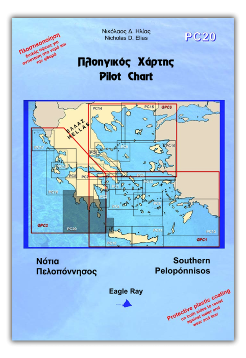
Product name: Pilot Chart PC20
- Nautical and piloting chart
- Laminated and tear resistant
- Updated with monthly NMs
- with waypoints marked in practical positions
- including local weather forecast
- the back side contains port plans
Includes: SW coast of Peloponnese, Messiniakós Gulf, Lakonikós Gulf, Monemvasiá Gulf
Islands of Kýthera and Antikýthera
- O. Navaríno and Pýlos marina
- Methóni harbour
- Koróni harbour
- Kalamáta harbour and marina
- Approaches and harbour of Gýtheio
- O. Vátika and N. Elafónisos
- Diakófti harbour (Kýthera)
- Monemvasiá gulf and marina
Sportbootkarten von Eagle Ray sind Seekarte und Pilot Chart in einem. Sie sind beidseitig farbig auf wasserfestem Papier gedruckt. Zusätzlich zu den üblichen Angaben über Küstenverlauf, Wassertiefen, Seezeichen usw. enthalten sie auch Informationen über Wolkenbildungen an den Bergen und viele weitere revierbezogene Informationen. Auf der Rückseite befindet sich eine große Zahl von Plänen größerer Maßstäbe der Durchfahrten, Ankerbuchten und Häfen des Reviers. Flachwassergebiete werden blau dargestellt. Die Seezeichen auf See und an Land sind vollständig eingetragen. Die Beschriftungen, Zeichenerklärungen und Tabellen sind griechisch und englisch.
| Cod.Art. | BD2698 |
|---|---|
| Nome prodotto | Pilot Chart PC20 - South Peloponnisos |
| ISBN | 978-960-89742-9-6 |
| EAN | 9789608974296 |
| Produttore / Editore | Eagle Ray |
| Diritto alla restituzione | Secondo i nostri termini e condizioni |
| Tipo di prodotto | Carta |
| Tipologia di prodotto | Carta |
| Categorie | Guida del porto / Portolani, Carta nautica |
| Lingua | Inglese, Greco |
| Paese / Regione | Grecia |
| Acque | Mar Ionio, Mar Mediterraneo |
| Autore | Nicholas D. Elias |
| Anno di pubblicazione | 2017 |
| Edizione | 2 |
| Tipo di rilegatura | Piegato, in una cartella di plastica |
| Scala della carta | 1:244'000 |
| Tipo di carte nautiche | 1:30'000 bis 1:300'000 |
| Lunghezza della carta aperta (cm) | 100 |
| Larghezza della carta aperta (cm) | 70 |
| Peso (kg) | 0.13 |
| Dimension 1 (cm) | 25 |
| Dimension 2 (cm) | 17 |


Validate your login
Registrati
Creare un nuovo account