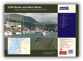
2700.1 Liverpool Bay to Anglesey
1: 280 000
Plans: Holyhead
2700.2 Anglesey and Menai
1: 145 000
Plans: Conwy Bay, Conwy
2700.3 Southern Anglesey and Lleyn Peninsula
1: 145 000
Plans: Porth Dinlläen
2700.4 Cardigan Bay to South East of Ireland
1: 300 000
2700.5 Cardigan Bay
1: 145 000
2700.6 Aberaeron to St David’s
1: 155 000
2700.7 St George’s Channel
1: 280 000
2700.8 Menai Strait and The Swellies
1: 70 000
Plans: Bangor and Beaumaris, The Swellies, Port Dinorwic,
Caernarfon, Llanddwyn Island
2700.9 Cardigan Bay Plans
1: various
Plans: Abersoch, Pwllheli, Porthmadog, Mochras Lagoon, Barmouth, Aberdovey,
Aberystwyth, Aberaeron, New Quay, Aberporth, Cardigan, Newport Bay,
Fishguard
2700.10 Tremadog Bay
1: 80 000
2700.11 Dublin Bay to Anglesey
1: 280 000
Plans: Dublin Bay
2700.12 Liverpool Bay
1: 145 000
Plans: Liverpool
| Cod.Art. | BD2758 |
|---|---|
| Nome prodotto | 2700 North and West Wales Chart Pack |
| Short Description | Anglesey to Milford Haven and St George's Channel |
| ISBN | 9781846237980 |
| EAN | 9781846237980 |
| Produttore / Editore | Imray |
| Diritto alla restituzione | Secondo i nostri termini e condizioni |
| Tipo di prodotto | Carta |
| Tipologia di prodotto | Carta |
| Categorie | Carta nautica |
| Lingua | Inglese |
| Paese / Regione | Inghilterra |
| Acque | Canale di Bristol, Mare d'Irlanda, Mare Celtico, Canale di San Giorgio |
| Anno di pubblicazione | 2016 |
| Tipo di rilegatura | Rilegatura a spirale |
| Tipo di carte nautiche | Set di carte - diverse scale |
| Peso (kg) | 0.676 |
| Dimension 1 (cm) | 42,0 |
| Dimension 2 (cm) | 59,0 |


Validate your login
Registrati
Creare un nuovo account