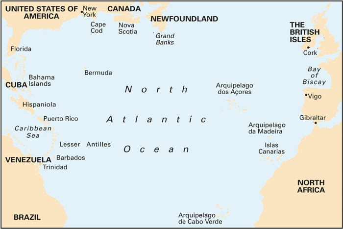
At a scale of 1:7,620,000 this chart covers the North Atlantic from Brazil to Newfoundland and Gibraltar to the Caribbean. It has been constructed on a conical projection that means that Great Circle tracks can be plotted as straight lines rather than curves.
The chart shows the main trend of contours, limits of ice, magnetic variations and keys routes as identified by DM Street. On the reverse are notes on the routes and small wind rose charts, with accompanying charts showing excessive wave heights and storm frequencies for the months that yachts cross the Atlantic: April to July and September to December.
Chart 100 is an important companion for Atlantic yachtsmen on passage and an excellent source of planning information.
printed and corrected to January 2021
| Cod.Art. | BD2730 |
|---|---|
| Nome prodotto | Chart 100 North Atlantic Ocean Passage Chart |
| ISBN | 9781786790699 |
| EAN | 9781786790699 |
| Produttore / Editore | Imray |
| Diritto alla restituzione | Secondo i nostri termini e condizioni |
| Tipo di prodotto | Carta |
| Tipologia di prodotto | Carta |
| Categorie | Carta nautica |
| Lingua | Inglese |
| Acque | Oceano Atlantico |
| Anno di pubblicazione | 2018 |
| Aggiornata | 2022 |
| Tipo di rilegatura | Piegato, in una cartella di plastica |
| Scala della carta | 1:7'620'000 |
| Tipo di carte nautiche | 1:5'000'000 und mehr |
| Lunghezza della carta aperta (cm) | 78,7 |
| Larghezza della carta aperta (cm) | 111,8 |
| Peso (kg) | 0.13 |
| Dimension 1 (cm) | 33 |
| Dimension 2 (cm) | 24 |


Validate your login
Registrati
Creare un nuovo account