


- MSD-Card, SD-Card
- CF-Card, MSD-Card
- MSD-Card, SD-Card
Nautical Charts
Country / Region
Aegean
Albania
Antarctic
Antilles (Greater)
Antilles (Lesser)
Azores
Bahamas
Balearic Islands
Belgium
Bulgaria
Denmark
Germany 2
Dodecanese
Dominican Republic
England
France 2
Greece
Haiti
Ireland
Italy
Jamaica
Canary Islands
Caribbean
Corsica
Croatia
Cuba
Cyclades
Leeward
Aeolian/Lipari Islands
Malta
Moldova
Montenegro
Netherlands
North Africa
North America
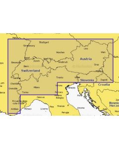
Austria 2
Portugal
Puerto Rico
Romania
Sardinia
Scotland
Sweden
Switzerland
Serbia
Sicily
Slovakia
Slovenia 2
Spain
Sporades (Northern)
Sporades (Southern)
South America
Turkey
Ukraine
USA
Venezuela
West Africa
Windward Islands
Cyprus
Waters
Aare 2
Adria
Aegean Sea
English Channel
Alboran Sea
Atlantic Ocean
Balearic Sea
Lake Biel 2
Inland waters Germany 2
Inland waters France 2
Inland waters Switzerland 2
Inland waters Italy 2
Lake Constance 2
Lake of Brienz 2
Danube 2
Lake Garda 2
Lake Geneva 2
By of Biscay
Gulf of Corinth
Gulf of Mexico
Gulf of Venice
Göta Kanal
Hochrhein 2
Ionian Sea
Irish Sea
Caribbean Sea
Celtic Sea
Sea of Crete
Lake Maggiore 2
Ligurian Sea
Linth (Linth Channel)
Lake Lugano 2
Lake Lungern 2
Sea of Marmara
Mediterranean Sea
Lake Morat 2
Lake Neuchâtel 2
North Sea
Rhine 2
Lake Sarnen 2
Black Sea
River Thames
Lake Thun 2
Trollhätte Kanal
Tyrrhenian Sea
Lake Lucerne 2
Vänern
Vättern
Walensee 2
Lake Wohlen 2
Lake Zug 2
Lake Zurich 2
Medium / product type
Product type


Shop
- Education
- Harbour guides
- Nautical Charts
- Books
- Equipment
- SALE
- Products for distribution
- Products for partner schools
- Gift vouchers
Validate your login
Sign In
Create New Account